


As I approached the lake, the first thing that hit me is the size of the gaping gully a hundred or so yards below the boat ramp. We had already carried our kayaks down the long boat ramp and through the sand, grass and weeds in search of the lake access. Earlier this year, when the lake was full and showing signs of a hopeful summer, water lapped against the boat dock at the end of the ramp. Now looking parched and exposed, the route to the lake at Rattlesnake Bar is through a dusty and eroding narrow crack in the earth.

For many, the boating season is over. California State Parks have imposed a speed limit of 5 miles per hour (mph) at Folsom Lake State Recreation Area since mid-July. Water levels are low enough in many places to make for hazardous boating. The lake is being drawn down to record lows as part of a plan to rescue the endangered winter-run Chinook salmon along with providing water to the 200,000 people who rely on it daily.
"Visitors are welcome to come out and enjoy Folsom Lake,” said Superintendent Richard Preston of California State Parks. “We want to make sure our visitors are aware of the increase in underwater hazards as a result of the low water levels. We urge people to exercise extreme caution while boating on the lake, both for their safety and to prevent damage to their watercraft.”
The speed restriction is necessary because the low water level has brought rocks on the lake bed closer to the surface, placing boats in danger in the more shallow areas. It is critical for boaters to exercise caution and to keep a proper lookout for hazards. Its bad news for speed boaters, but it's an opportunity for kayaks, canoes and SUPs to explore areas of the lake that are usually underwater without heavy boat traffic. However, as we found out, it's a long way to the water's edge.
It's my paddling partner Carly Mariani's first time up the North Fork of the American River. I'm sure she expected a simple cruise around Lake Natoma instead of what I have in mind. Before the end of the day she will invent a new term "Hikayaking," a combination of hiking with your kayak.
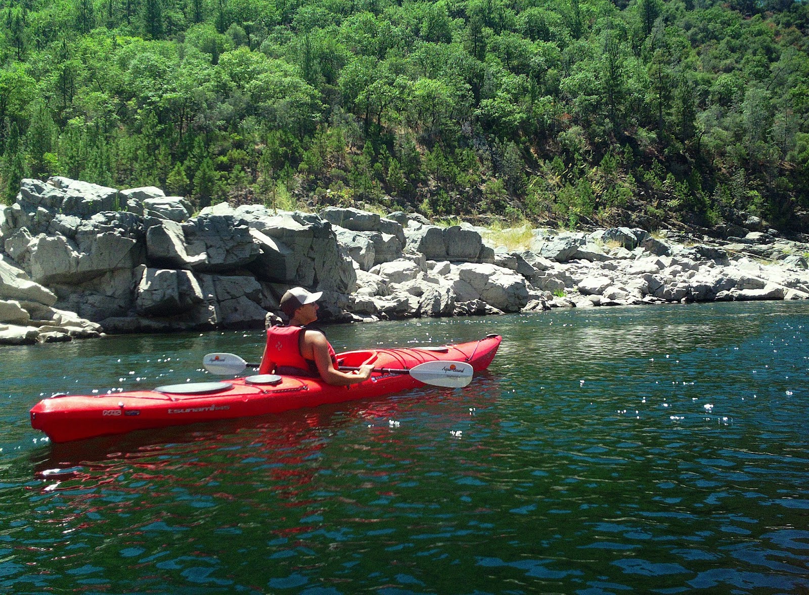
We paddled along under a dazzling brilliant blue sky. From our kayak viewpoint, the lake forms into three layers. There is the blue of the water. The shoreline is a desolate layer with rocks and boulders arising from the depths and inhaling the sun for the first time. Overhead, a thin black bathtub ring lines the upper portions of the rust-colored canyon walls and stones revealing the former water mark. Above that lies the green and brown thirsty timberline and undergrowth.
The lakeshore now reminds me of the surface of the moon. Down towards the Granite Bay access, folks drive down to the water's edge across the baked and dehydrated lake bed devoid of any trees or vegetation. It is a winding trail through ruts, dips and boulders to get to the lakefront. For now, at least, there is some water.
In the fourth year of the California drought, some lakes and river areas are a gurgle of their former selves. The dwindling Kern and Truckee rivers have ended the boating and tubing seasons before the summer ever began. The Kern River Festival, which draws hundreds of professional and recreational paddlers each year, was canceled this spring for the first time in 51 years, while the Reno River Festival's signature kayaking competitions also were dropped.
"It's the worst drought we've seen in the 30 years we've been here," Tom Moore of Sierra South Paddle Sports told the LA Times, "We've sunk to new lows. "
Drydocks, barren landscapes with landlocked boats and boat ramps in puddles are some of the sights seen in the California Department of Water Resources' new aerial video shot above lakes Oroville, Shasta and Folsom reservoir. Their only hopes for more water cling to the expectation of this winter's El Niño forecast.
We ascended the North Fork much like climbing up an assemblage of steps. In places, the river is a trickle strangled through small rapids between placid pools. At each rapid we approach, we were forced to get out and wade through the rushing water. Footing was uneven and slippery. When the lake was higher, earlier in the spring, it was a relaxing upstream paddle. Now it's a shallow rocky fast-moving stream between pools. I reminded Carly over and over that the portages are a fun and exciting way to view the river as we will be well rewarded with a fun bouncy ride back on the return trip.

As we wondered about the next rapid on the horizon, weather forecasters are pondering El Niño. For months, climate scientists have said El Niño is likely to bring more rain to California this winter, The biggest question is, how much moisture and where will it fall?
“It’s still a bit premature to know if we’re going to have strong El Niño conditions during our wet season this winter, but the probabilities are increasing toward 80 percent or something,” told Marty Ralph, a climatologist with the Scripps Institution of Oceanography to NBC 7 San Diego.
After studying California weather for 25 years, he says this summer resembles the lead up to the strong El Niño of 1997-1998 when storms battered Golden State. Still, he believes it’s premature to say we’re in store for another winter like that one. “Wishcasting doesn’t mean it won’t happen."

Near the bone-dry Pilot Creek about 3 miles from Rattlesnake Bar, we found a nice-sized pool below a wave train of newly uncovered Class I rapids. Here a large rock with turtle-shaped head peers over the deep and blue water. This is where the river turns toward the east, and where our trip upriver stops.
In the springtime when the lake was high, I paddled further, but now we had to settle here.
After a snack and swim we will enjoy a quick jaunt back down river. The Class I and II flows, despite the drought, made for a fun exciting ride back to the lake.
To learn about all the actions California has taken to manage the water system and cope with the impacts of the drought, visit Drought.CA.Gov.
No comments:
Post a Comment