Showing posts with label Angel Island. Show all posts

Friday, June 7, 2019

THE LEARNING CURVE


This past April, Kathy Bunton owner and operator of Delta Kayak Adventures based in Antioch, California took part in an American Canoe Association Coastal Kayak Instructor Development Workshop and Certification session in San Francisco Bay. Bunton chronicled her three days of challenging and comprehensive education and training in her blog Kayaking in the California Delta, this past month which is being republished in Outside Adventure to the Max.

By Outside Adventure to the Max Guest Blogger Kathy Bunton


Last weekend, I was fortunate to complete a goal I have had for some time. I took part in the Level 3 IDW, Instructor Development Workshop, put on by Sean Morley of River and Ocean. It was an absolutely amazing experience and exceeded my expectations of intensity.
To be honest I was a little anxious about taking this workshop. I knew I was ready but didn't really know what to expect. Sean did an excellent job of preparing us beforehand by emailing us assignments and background information before the workshop began. The IDW takes place concurrently with the Instructor Certification Exam otherwise known as the ICE. Two out of the seven of us would be taking the exam.

Sean Morley was our Instructor Trainer and was assisted by Larry Wagner of Kayak Connection in Moss Landing. Both are incredible instructors with extensive kayaking and teaching experience.

Before I share my experience, let me give you a little background information on the American Canoe Association, aka ACA, and what it represents.
Briefly, the ACA is an organization that advocates for paddlers on the local, state, and federal levels, on a range of public policy issues pertinent to paddling education and safety.
  • They work towards creating greater access to rivers, streams, lakes, bays, and coastlines.
  • Addresses paddlesports education standards from state to state.
  • Represent paddlers in meetings concerning boat registration issues
  • Represent paddlers with state and federal entities.
They also play a huge role in stewardship. The ACA is committed to making the world a better place to paddle. Our paddling community explores waterways from small streams to the sea, making paddlers stakeholders and potential stewards of all waterways.
The ACA's Paddle Green and Stream to Sea programs focus on conservation and education activities that protect the environment, strengthen peoples connection to the outdoors, and foster stewardship ethics that protect our natural resources."
I strongly encourage you to join the ACA because they provide a huge amount of resources and support for all types of paddlers.

Photos courtesy of Kathy Bunton
Day 1
One of the best decisions I made was staying at a hotel for the entire weekend. My friend, who was doing the instructor certification exam, and I stayed at the Travelodge in Mill Valley. We arrived Thursday evening and right away began studying, watching YouTube videos and going over what we had prepared for the next day.
We awoke Friday morning at 6 a.m. and began packing up our gear and lunch for that day's instruction. We arrived at Sea Trek in Sausalito a little before 8 a.m. and made our way to the classroom.
After introductions and an overview of what the day would look like, we turned in the lesson plans we had prepared and spent a couple hours going over ACA class requirements, how to register and report classes we would teach and teaching and learning theory.
We then geared up and prepared to launch. Our instructor trainer, Sean, then demonstrated how a stroke should be taught using the side slip as an example. We spent a good amount of time working on this stroke and playing a game to hone our skill.
In order to be certified at Level 3, each instructor trainee must be able to perform the following strokes with skill and efficiency and be able to teach and assess each skill effectively and efficiently: FORWARD STROKE, SWEEPS (forward & reverse), REVERSE (& stopping), DRAWS (to hip, sculling draw, on the move), BRACES (high, low, sculling), LOW BRACE/HIGH BRACE TURN, RUDDERS (bow & stern), EDGING and SIDE SLIP.
After working on the side slip, we landed at a beach for lunch and while eating received a 10-minute presentation on tides and currents.
Each trainee was assigned to do one presentation during the IDW/ICE.
Back on the water, it was my turn to teach one of the strokes. I chose the stern rudder. After which I critiqued myself and was given feedback from participants.
We then paddled back to Sea Trek to be videoed of us performing each of the above strokes and a roll. Workshop participants are not required to roll but those taking the exam are expected to execute a roll. I've been working on my roll and have been successful in the pool but have not been successful in real water.
After being videoed we loaded our kayaks and dressed into warm dry clothes and headed back to the classroom to watch and critique what we had just done. It was great to be able to watch ourselves and see where we could use improvement. Everyone was kind and thoughtful but truthful which is always best if you really want to improve technique. We left sometime after 6pm, grabbed a bite to eat and headed back to the hotel to study and watch more videos.

Day 2
We arrived at Horseshoe Cove at 8 a.m. and were greeted with a stiff breeze. The wind was blowing 12 knots with gusts to 19 or 20. The conditions were borderline Level 3 and above but each trainee had the skills to paddle and teach in these conditions.
After a review of day 1, we launched and headed out the gate towards Kirby Cove. Two trip leaders were assigned for this leg of the journey and were required to teach a stroke along the way.
We landed safely at Kirby Cove and presentations on Compass use for Navigation, towing and nautical charts were given.
After lunch, we were back on the water and began teaching and demonstrating paddle float rescues. My friend and I were then assigned as the trip leaders for our leg back under the gate. When we reached the bridge the tide was still ebbing and created a strong current against us as we rounded Lime Point.
The rest of the afternoon was spent on rescues and strokes. In order to be certified Level 3, the following rescues must be taught and demonstrated effectively and efficiently: WET EXIT (with spray skirt), SELF RESCUES (scramble, paddle-float), T-RESCUE (& variations), BOW RESCUE (& variations), INCAPACITATED PADDLER RESCUE (Scoop) UNRES PONSIVE PADDLER RESCUE (Hand of God),SWIMMER RECOVERY (bow, stern deck). ICE candidates then turned in their float plans for day 3 and we discussed what the best options would be considering the weather and current predictions.
We finished up again around 6 p.m. and headed back to the hotel for more studying.

DAY 3
I woke up around 6:30 a.m. Sunday and began experiencing some tummy issues. I could tell I was extremely low on energy and prayed I could make it through the day.
We were having some guest paddlers from Western Sea Kayakers and Kayak Connection join us for the day so we would be working with "real" students. We again met at Horseshoe Cove at 8 a.m. and prepared to launch with our students. We went over the float plan for the day with the plan to paddle to Angel Island via Richardson Bay to beat the ebbing tide.
The wind was up again and I began to have doubts about whether I could complete the workshop. We broke into two pods with Sean taking one group and Larry taking my group. We were to continue teaching rescues on our way to Angel Island.
I was assigned the Hand of God or Scoop rescue to teach. Both of these rescues take a lot of strength and I pretty much knew I didn't have it in me, but I was determined to try.
I had a glimmer of hope when someone spotted a whale spout in the bay. I turned to see it just in time as it dove beneath the choppy water and reminded myself why I was doing this.
It was my turn to teach the scoop rescue and after finding a willing volunteer, I proceeded. It didn't go well. I was able to get the paddler into his boat but upon trying to turn him and his boat over I proceeded to dump both of us in the water.

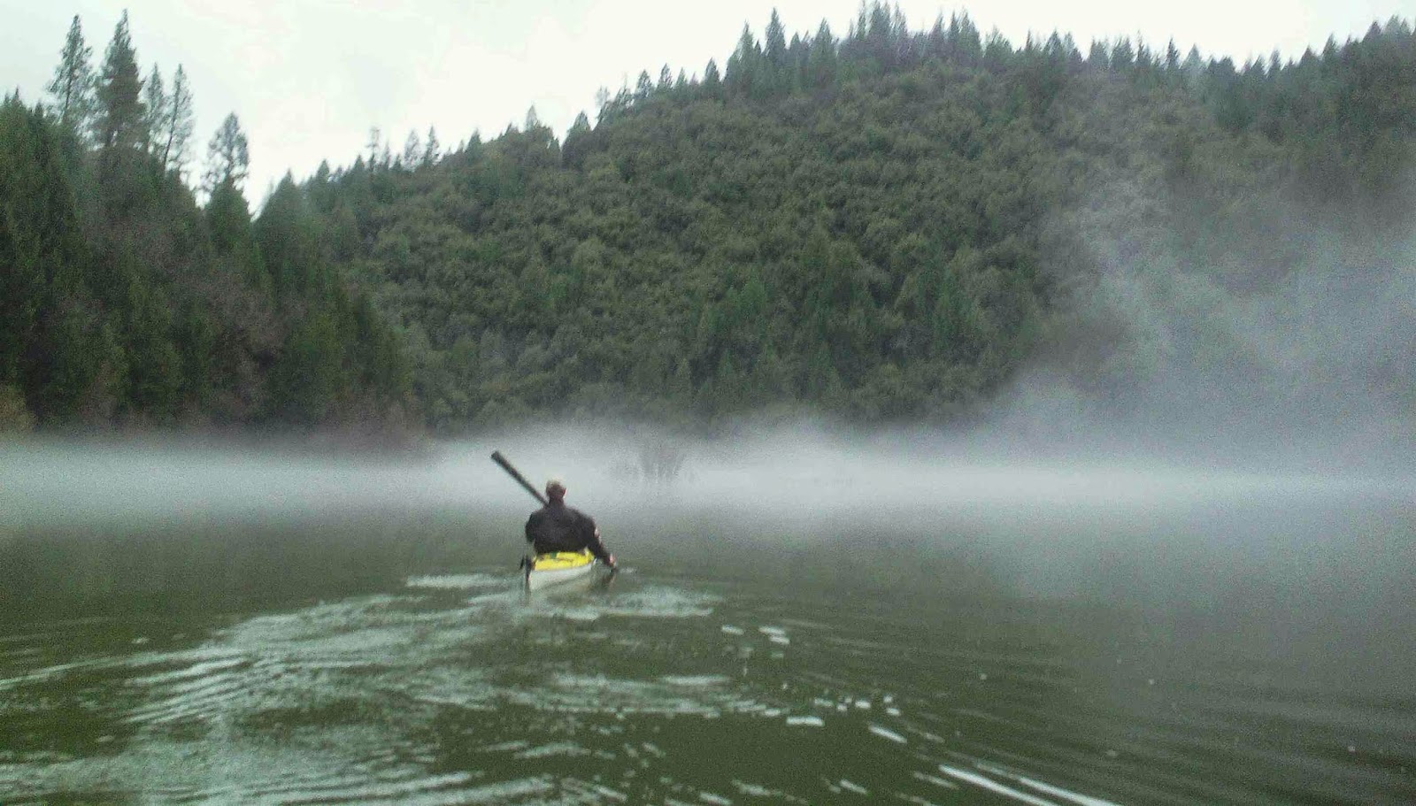
Kathy Bunton on the Bay
Frustrated and discouraged, I got back into my boat and knew I would not physically be able to make the paddle to Angel Island. I was confident I could get there, but with the wind against us, I feared I wouldn't have the strength to paddle against it on our way back.
I pulled Larry aside and shared how I was feeling. Without hesitation, he radioed Sean and both groups merged to discuss options.
Thankfully, it was decided that we would not paddle to Angel Island and instead continue to work on rescues, towing and strokes near Yellow Bluff.
We broke for lunch and I did my presentation on Hypothermia. I received some great feedback and plan on implementing the suggestions when I teach. I felt bad for wimping out on the paddle to Angel Island, but a few paddlers mentioned to me that they were glad we didn't go. Not sure if they were trying to make me feel better, but was glad to hear I wasn't the only person who was tired.
We made it back to Horseshoe Cove around 4 p.m. and thanked and said goodbye to our practice students. We loaded our boats and gear and headed to the Presidio Yacht Club for a beer, debrief and evaluations.

Conclusion
This was definitely one the most physically challenging endeavors I have ever partaken in but also the most valuable. I can't begin to explain how much I took away from this experience.
In the end, I was certified as a Level 2 ACA instructor and I look forward to taking my Level 3 exam next spring.
I couldn't have asked for a better instructor than Sean Morley and I also learned much from Larry Wagner.
The group itself was made up of extremely skilled guides and paddlers and were so fun to be with!
I have left quite a bit out of this post but hope this gives you an idea of what is involved in becoming a certified instructor. My highest respect goes out to all certified instructors who have taken the time to be the best they can be on the water.
Kayaking is a sport that involves life long learning and that is one of the reasons I love it so much. Keep on paddling!

Kathy Bunton is the owner and operator of Delta Kayak Adventures based in Antioch, California.  You can keep up with Bunton in her blog Kayaking in the California Delta.  

Outside Adventure to the Max is always looking for guest bloggers. Contact us at Nickayak@gmail.com, if you are interested.

Want to see more about Outside Adventure to the Max. Follow us on Facebook and Instagram


Friday, June 3, 2016

RIVERS, ISLANDS, AND MOUNTAINS


                                         I cannot rest from travel: I will drink 
                                      Life to the lees: All times I have enjoy’d
                                   Greatly, have suffer’d greatly, both with those
                                  That loved me, and alone, on shore, and when
                                        Thro’ scudding drifts the rainy Hyades
                                       Vext the dim sea: I am become a name;
                                       For always roaming with a hungry heart 
                                                 Alfred Lord Tennyson

On a clear day at access at Sailor bar, I can see the Sierra Nevada Mountains They're snow-capped,  looming and like John Muir said calling for us come. In between are the forks of the American River brimming with spring runoff, roaring down to the basin. Turning to the west, it's a water trail to the Pacific. Down the American River, pouring into the Sacramento River and the Delta before reaching  San Francisco Bay. In some places the water is slow and gentle, almost meandering lost without direction, while in other places it's quick and furious moving with such force that it has carved out the canyon that cradles it.  However, water isn't concerned about the past, it lives in the now. Leonardo Da Vinci said, "In rivers, the water that you touch is the last of what has passed and the first of that which comes; so with present time."

 "One of the reasons I love whitewater kayaking to much is that it forces you to focus on the moment," wrote a former member of the Canadian Freestyle Whitewater Kayak Team and Bronze medalist Anna Levesque in her recent Girls at Play newsletter. " If you don't pay attention in a rapid you could end up somewhere you don't want to be. People are addicted to whitewater kayaking because they felt that intense joy that comes with being really present, at the moment. You don't have to be a whitewater kayaker to experience this. Sea kayakers experience this and lake paddlers who can get really quiet and pay attention to the beauty around them are also able to experience the present moment"

Some good advice as we head into the summer paddling season. It's great to look back on our experiences on the water, but we should be reminded that our best days are just any days we are paddling. So seize each day and enjoy each moment in the mountains, lakes, rivers.

Here are a few of my favorite images from this year so far.

Lake Natoma

Lake Jenkinson

South Fork of the American River

Lake Tahoe

Lake Natoma

South Fork of the American River

Angel Island

Lake Tahoe

Friday, May 27, 2016

RETURN TO ANGEL ISLAND

 
The struggle for spirit has replaced the physical, and in his evolution psychologically man’s greatest minds have become aware of the emptiness of material striving. The struggle has become a positive drive toward perfection, all in keeping with his final hope: realization of the kingdom of God within him. – Sigurd Olsen

The day started much like all my other trips. An early morning two-vehicle caravan from Sacramento, along Interstate-80, to Highway 101 and then unloading our kayaks in the shadow of the Golden Gate Bridge at Horseshoe Bay. Hazy skies and calm seas greeted us along dozens of Marin County Firefighters taking part in a training exercise at the Coast Guard station there. It was a  reminder that some of the wildest sea conditions on the entire West Coast can be found just past that sea wall. The bay is known for steep waves, fast and swirling currents and howling winds blowing through that Golden Gate. On the eastern horizon emerged Angel Island.

In August 1775, across the continent, the American revolution was just beginning. George Washington had just taken command of the Continental Army.  In England, legendary sea Captain Cook had just completed his second voyage around the world and looking out from where we currently were,   Lt. Juan Manuel de Ayala had brought his ship, the San Carlos, into San Francisco Bay for the first time.  Every other sea captain like Francis Drake had sailed on past the fog encased bay entrance by the time Ayala stumbled upon the now world-famous bay.
His purpose for the trip along the California coast was to give a detailed account of the area that future Spanish ship captains. Ayala’s pilot, Don Jose’ de Canizares, explored and mapped the bay, while Ayala stayed aboard the San Carlos anchored in a little cove island that now bares his name.  Following a custom then common among Catholic explorers of naming sites for the religious feast days nearest to the time of discovery, he christened Isla de Los Angeles, (Spanish for Island of the Angels).

"This is certainly a fine harbour," Ayala reported "It presents on sight a beautiful fitness, and it has no lack of good drinking water and plenty of firewood and ballast. Its climate, though cold, is altogether healthful and it is free from such troublesome daily fogs as there are at Monterey since these scarcely come to its mouth and inside there are very clear days"
Ayala and his crew stayed for 45 days along the island exploring, mapping and trading with Indians, only to sail out the bay and NEVER return.

It would be his loss. I mean who hasn't left their heart in San Francisco. Angel Island now part of the California State Parks system is just one of the many gems the Bay Area. This is my second kayaking-camping trip to Angel Island with members of Bayside Adventure Sports, an active Sacramento based outdoors church group. Transformation through recreation in God's creation is the guiding ideal for participants. The group organizes weekly biking, hiking, skiing, and kayaking outings, along with camping and ski trips throughout the year.


"Starting a good tradition," said Brian Hughes, one of the paddlers on the trip,  "Each year is different because of different weather conditions and exploring different parts of the island and the Bay. It's a challenging experience with awesome buddies. It has made me appreciate God's creation and the value of friends."

We caught the "Flood" tide for a free tide directly to the island. Our hearts seemed to pound a little harder as we exited Horseshoe Bay and feel the surge of the ocean. My longtime paddling partner Erik Allen and I traded off taking the lead across the 3-mile stretch as Angel Island loomed ahead of us, getting larger with each stroke.

Last year, Hughes paddled a sit on top kayak and towed a paddle board. This year he has a sleek sky blue touring kayak he is paddling for the second time since he bought it. Ron Bischel missed last year's trip us and is kayaking the bay for the first time. It's an easy paddle till we catch the swell of the rapid waters of Raccoon Straights. It pushes us past Stuart Point and towards the shore of the island. Up the hill through the trees is our campsite.

In an article titled Catching the Late Show in this year's spring issue of Adventure Kayak, writer Charlotte Jacklein says it's a fundamental fact that one of the greatest things you can do with your kayak is to go back-country camping. She wrote, "Day trips are certainly fun and beneficial, but camping out of your kayak exponentially magnifies all the joys of paddling and spending time in nature with friends."

Angel Island is within view of 4.8 million people around the Bay Area and has countless visitors on daily basis hiking Mount Livermore and touring the historic features of the island. But, when the last ferry left and the sunset, the island was pretty much its own world. It became an extraordinary backcountry adventure, offering the solace of any wilderness camp except it had stunning views of the Golden Gate Bridge and the twinkling lights of San Francisco. That night tired after paddling in the wind around the island we reflected and philosophized about the day's paddle, life and God in tranquility.

 "Fellowship and strenuous fun, " said Hughes, "It is a major part of my social and faith connection.  Without it, I wouldn't have much going on that gets me revved up. We had one less person this year, but was still good"

Paddling guru Sigurd Olson knew about paddling and camping together and how it can lead to deeper understanding of our relationships with each other, nature and ourselves when he wrote "There have been countless campfires, each one different, but some so blended into their backgrounds that it is hard for them to emerge. But I have found that when I catch even a glimmer of their almost forgotten light in the eyes of some friend who has shared them with me, they begin to flame once more. Those old fires have strange and wonderful powers. Even their memories make life the adventure it was meant to be."


We hiked to the top of the 788-foot Mount Livermore the island tallest point on the island the next day before paddling back to Horseshoe Bay. It was a few days away on land and sea that recharged our lives and souls till we all can paddle and camp together again. Ayala may have never returned, but I'm looking forward to more paddling trips with the guys to the little bay island for many years to come.

 Click on the following links for past stories about kayaking in San Francisco Bay and visiting Angel Island in Outside Adventure to the Max.

 PADDLING SAN FRANCISCO BAY: VIDEO BLOG
Angel Island
Under the Golden Gate

Friday, November 20, 2015

PADDLING SAN FRANCISCO BAY : VIDEO BLOG


The hard work is not only part of the fun of it, but it beats the doctors. San Francisco Bay is no mill pond. It is a large and draughty and variegated piece of water. I remember, one winter evening, trying to enter the mouth of the Sacramento. There was a freshet on the river, the flood tide from the bay had been beaten back into a strong ebb, and the lusty west wind died down with the sun. It was just sunset, and with a fair to middling breeze, dead aft, we stood still in the rapid current. --Jack London

It is undeniably one the greatest views ever. The Golden Gate Bridge a vision that has inspired story, song and poem. On its opening ceremony in 1937, its chief engineer Joseph Strauss said, "This bridge needs neither praise, eulogy nor encomium. It speaks for itself. We who have labored long are grateful. What Nature rent asunder long ago, man has joined today." When asked how long the bridge would will last? His answer was concise. "Forever." he replied.
Forever, I will have that memory of kayaking out of Horseshoe Bay. The bridge, the mystical structure shines to my south."Its efficiency cannot conceal the artistry. There is heart there, and soul. It is an object to be contemplated for hours." That is what longtime San Francisco Chronicle columnist Herb Caen wrote when he described his reverence of the triumphant structure. I feel the same sentiment. When I think back on all the places I have ever wanted to kayak. I had dreamed of clear forest lakes, whitewater in a rocky mountain canyon and a sea view of the Golden Gate Bridge. Just to be near the bridge was an overpowering feeling. It was hard to take my eyes off it. Even when I turned to the east, towards Angel Island, I found myself looking over my shoulder enraptured by its sight.

I'm was going solo for first part of the trip. It was early spring morning, the winds were light and the tide was in my favor. I had picked a good time to paddle. San Francisco Bay is legendary to sea kayakers. It has some of the wildest sea conditions on the entire West Coast. The bay is known for steep waves, fast and swirling currents and howling winds blowing through that Golden Gate that require advanced paddling skills. "It really blows on San Francisco Bay," cited American author Jack London, "During the winter, which is the best cruising season, we have southeasters, southwesters, and occasional howling northers. Throughout the summer we have what we call the "sea-breeze," an unfailing wind off the Pacific that on most afternoons in the week."


I'm was crossing the bay to meet up a camping party for an overnight on Angel Island.  They had come the day before and I was joining them.  My kayak, loaded up with camping gear, a change of clothes and assortment of freeze-dried foods and power bars. To my left was Richardson Bay and Sausalito, to my right was Alcatraz Island and San Francisco and behind me the Golden Gate Bridge. Straight ahead is was Angel Island silhouetted against the sun. Its dark mass rises out of a hazy glow before me. My day had just begun.

Canadian author Gilbert Parker wrote, "It must be remembered that the sea is a great breeder of friendship. Two men who have known each other for twenty years find that twenty days at sea bring them nearer than ever they were before." Close to water, vulnerable to its brunt and force, my kayak companions from Bayside Adventure Sports have bonded together well this past year with a shared camaraderie and ministry of paddling in God's creation. BAS is an active outdoor church group based in Granite Bay, California and sponsors many of my paddling activities.

After unloading my gear and quick breakfast, I was back on the water again with the group. We made a quick trip across Raccoon Straights to Tiburon followed by a run back through the straights and around the island. We faced wind and waves on the island's west and tranquil waters on its east while circumventing the bay island. Each stroke of the paddle was a triumph. Each bounding swell an adventure. "Why do we love the sea?" stated American artist Robert Henri, "It is because in has some potent power to make us think things we like to think." The next day, we returned towards Horseshoe Bay and the bridge hidden somewhere in the clouds.

Friday, October 2, 2015

ISLAND IN TIME, TOMALES BAY PART I


"We need to keep some of our vanishing shoreline an unspoiled place, where all men, a few at a time, can discover what really belongs there -- can find their own Island in Time." ---Harold Gilliam

The area outfitter gave us a stern warning. "Weather is moving in. Tomorrow it could be worse." she stated firmly, "We had a lot of rescues over the weekend. If you go out there you might not make it back."
We had all seen the weekend report of fifty-four kayakers on a nocturnal outing being plucked out of Tomales Bay by local fire departments when the conditions suddenly changed. Two were treated for hypothermia after a kayak capsized in the wind and rough seas.
A gray sky hung overhead while two-foot waves pounded Miller Boat Launch at Nick's Cove on the northern section of the bay as we continued unloading our kayaks and gear.  I saw the outfitter's tired eyes looking out over the water watching her crew retrieve kayaks from across the water, remnants of the past weekend's rescue operation. Her crew's motorboat with kayaks in tow seemed to make slow progress across the bay.

 "The little boat, lifted by each towering sea, and splashed viciously by the crests, made progress that in the absence of sea-weed was not apparent to those in her. She seemed just a wee thing wallowing, miraculously, top-up, at the mercy of five oceans." That's how American author Stephen Crane described the ordeal in his short story The Open Boat. The story is based on his own experience of surviving a shipwreck.  In classic literary style, he would narrate the tale that seemed to match my view of the motorboat crossing the bay. "As the boat caroused on the waves, spray occasionally bumped over the side and gave them a fresh soaking, but this had no power to break their repose. The ominous slash of the wind and the water affected them as it would have affected mummies."

I looked to the members of our five-man party all loading their kayaks with camping supplies. We had all paddled together in San Francisco Bay and camped on Angel Island. The conditions seemed similar, wind, waves and a little current. Nothing we had not paddled together before. "You know what we call a day like this in Minnesota?" I asked the group with a with a smile and then answered quickly not waiting for an answer, "A nice day."
The outfitter shook her and continued with her loading of kayaks. Her warning had disappeared in the wind. We had planned this trip to Tomales Bay for weeks. It was a scouting mission of sorts. We are looking forward to bringing other folks along on a future camp out as part of Bayside Adventure Sports, an active outdoor church group based in Granite Bay, California. The idea was to find a suitable beach for camping and viewing of the bioluminescence along the Point Reyes National Seashore. All we had to do was paddle out past Hog Island to the western side of the bay, about a mile away.
"A singular disadvantage of the sea lies in the fact that after successfully surmounting one wave you discover that there is another behind it just as important," Crane observed in The Open Boat in enduring the test of the ocean swells. Loaded full with camping gear, the waves crashed over my bow putting a salty spray in my face. I was the last one trailing behind the others heading into the gusty bay. Memories of paddling the mid-west lakes floated back to me. There wind and waves are commonplace. I can remember, one windy day on West Lost Lake in Minnesota where I battled whitecaps while paddling along the Otter Tail River chain of lakes. Up and down my kayak bounced along in the same fashion across the bay.

Hog Island sits about five miles south of the entrance of Tomales Bay. Small in nature the uninhabited island covers only two acres, while its next-door neighbor Duck Island is even smaller. A haven for wildlife, the islands are managed by the National Park Service as part of the Point Reyes National Park Seashore and access in restricted. However, it did serve as a good rendezvous spot out of the wind as we all paddled between the two islands. Near the western shore of Tomales Bay the wind eased up and the waves ceased. While the other three paddled ahead into the cove with sand-colored cliffs called White Gulch, longtime paddling partner Erik Allen cruised the along the shoreline looking for a beach to camp on. From the shore, we heard the bugling sound of the tule elk. In the distance, we could see them grazing freely in open grasslands and coastal scrub. Once almost wiped out, the elk have returned to Point Reyes and are one of the largest herds in California.

Under the shelter of Tomales Point blocking the winds coming off the Pacific Ocean, the tempestuous bay calms yielding way to smooth paddling along the coastline of the bay. It's a mixture of sandy beaches, high bluffs and thistle plants clinging to the rocks and tall banks. The vegetation huddles close to the ground.  Coyote brush and grasses are the dominant plants on the peninsula. It may look quiet but its home to all the animals, birds and reptiles. Higher up and lining the draws are a full array of Douglas fir, Bishop pine and coastal live oak.

Conservationist and writer Stephen Trimbles
said, "To cross this valley to the peninsula (Point Reyes) is to leave modern California and enter an island of wilderness, forgotten by progress, a quiet land misplaced in a noisy world." We picked out a quiet beach along the coastal prairie almost directly across from the noisy world, where had we started. Pulling our kayaks on to the shore, we pitched our tents in the sand, ate freeze-dried food and watched the tide roll away. The weather and waves and warnings faded into the tranquil sound of the water lapping against the shore. Resting around a beach fire, we found own haven by the bay.


Photos by Erik Allen & Jim Bryla. 
Next week in Outside Adventure to the Max find the magic during a bioluminescence excursion in Tomales Bay.

Friday, May 29, 2015

Angel Island


The winding trail keeps going up. Climbing steady with the view of the bay ever-changing. It started on pavement, leading to steps and then a trail twisting through a canopy of oaks and madrones. Crossing over the fire road the North Ridge Trail is interrupted with a picture post card view of Ayala Cove.
In the summer of 1775, Captain Cook has just completed his second voyage around the globe, George Washington was given the command of ragtag bunch of rebels fighting in a fledgling revolution and Juan Manuel de Ayala and crew of the San Carlos became the first vessel to enter the world's greatest natural harbor of San Francisco Bay.
Ayala later reported, "It true that this port is good. Not only for the beautiful harmony that offers to the view, but is does not lack very good fresh water, wood, ballast in abundance. It's climate though cold, is healthful and free of those troublesome fogs we had in Monterey."
Spanish navigators had been missing it for more than 200 years, but on Aug, 5th  The San Carlos battling powerful currents and using a crescent moon to steer by slipped past the Golden Gate into the bay. He saw an island and named it Santa Maria de los Angeles or as we call it in present-day Angel Island. Looking to protect his ship, he anchored it in Ayala Cove and remained there for nearly a month while is crew explored and mapped the bay area for the first time.

Over looking that cove today, ferryboat after ferryboat cruise in daily dropping off and picking up tourists at the island's visitor center and museum. The little cove is abuzz with activity as  visitors look forward to their new discoveries on the island.
 I'm here with four others from Bayside Adventure Sports. A church sports group based out of the Sacramento area. While most people visit the island via ferryboat, we all paddled in  and are camping at the kayak camp on the northwest side of the island. I had paddled around the island earlier today and now the goal is to hike to its top. A 788 foot climb up Mount Livermore.
The entire island is within Angel Island State Park boundaries and administered by California State Parks. The island has a history of being used in a variety of purposes including, military forts,  missile site,  an US Public Health Service Quarantine Station, and an US west coast Bureau of Immigration inspection and detention facility. Historic building, battery strongholds and installation facilities have been left behind to view on guided tours.
We are steadily climbing up North Ridge Trail on the east end of the island.  We have ascended between 500 to 600 feet since leaving the visitor center. Through the trees we catch views of old Fort McDowell and the bay.  It's a sailor's paradise today. Vessels can be seen skimming across the water in every direction. Their white and shiny sails bounding over their tops on the blue water. Like stars in the heavens there are way to many count.

It's a 5 mile trek around the island. For a dollar extra people can bring their bikes on the ferry or rent one in Ayala Cove while visiting the island. There are 13 miles of hiking trails and roadways on Angel Island. Cyclists have access to 9 of them. However, for the two and half mile trip up to Mount Livermore its all hiking. Steep switch-backs make the trail challenging to even the best of hikers.
At 700 ft. the trail splits into three. While two trails lead back down and one goes to the summit. The trees yield way to the bay for its view. There is still evidence of the 2008 fire that scorched 250 acres there. At 88 more feet we were rewarded with an island's awe-inspiring expansive 360° views of the San Francisco skyline, Alcatraz, the Golden Gate Bridge and Marin County.


It is a view Ayala never got to enjoy for himself.  Ayala had accidentally shot himself in the foot and left most of the exploring to his sailing master Jose de Canizares. On September 17, 1775 he sailed the San Carlos back out through the Golden Gate never to return again. A year later explorer Juan Bautista de Anza led the first colonists to the hilly peninsula facing the Golden Gate and and chose site for the  future city of San Francisco.

 Our visit was short also. When we loaded our kayaks up with our camping gear and paddled away the next morning, unlike Ayala we all look forward to our next visit to the little island.

Saturday, May 23, 2015

Under the Golden Gate

I come back to the sea. In my case it is usually San Francisco Bay, than which no lustier, tougher, sheet of water can be found for small-boat sailing. It really blows on San Francisco Bay. During the winter, which is the best cruising season, we have southeasters, southwesters, and occasional howling northers. Throughout the summer we have what we call the "sea-breeze," an unfailing wind off the Pacific that on most afternoons in the week blows what the Atlantic Coast yachtsmen would name a gale. ---Jack London

When I think back on all those places I have ever wanted to kayak. I would dream of clear forest lakes, whitewater in a rocky mountain canyon and a sea view of the Golden Gate Bridge.
It is undeniably one of the greatest views ever. The Golden Gate Bridge is an icon of America. As I began unloading my kayak into Horseshoe Bay just to the north of the bridge, even in the early morning hours,  folks have already begun to congregate at the water's edge with their eyes fixed on the bridge in reverence.
It is a calm and beautiful morning. Out of the safety of Horseshoe Bay, I have heard about what challenges await. San Francisco Bay is legendary to the sea kayaker. Some of the wildest sea conditions on the entire West Coast can be found just past that sea wall. The bay is known for steep waves, fast and swirling currents and howling winds blowing through that Golden Gate. The last time my paddling partner, Erik Allen and I paddled the bay we faced a tiring wind on the return trip. I laughed at it anyway.
"You have never paddled Lake of the Woods at Zipple Bay, have you." I told Erik, and then exaggerated just a little, "They use a log chain for a windsock there."
Erik might have been concerned about the wind,  however, I'm worried about the tides and currents. Sea kayaking is still a foreign language to me. Ebbs, slacks, floods, and tide tables make up words in a sea kayaker's secret code. A flood tide makes it easier to paddle out while ebb will aid in the return. Finding the ideal time optimal for one's paddling experience.
Adding to even more the chaos are the pleasure crafts, ferries and ocean-going vessels competing for the same waterway. All of these factors should be considered when paddling in the bay and caution should always be exercised.


I picked a good time to paddle. It is early and the winds are light and the tide is in my favor.  I'm going solo across to Angel Island to join my camping party for an overnight on the island. They came the day before and I will be joining them. My kayak is loaded up with my camping gear, a change of clothes and an assortment of freeze-dried foods and power bars.
My heart races as I exit the Horseshoe Bay and enter the swells of the ocean. It is an exhilarating feeling as I round Yellow Bluff, a 90-foot cliff just of east of Horseshoe Bay. The waves crash gently against its walls. I enjoy views of seals bobbing their heads up above the surface of the water.  They are my only company so far. It is way to early for ferryboats. Their traffic won't begin till mid-morning. I stay along the shore for a while before making a northeastern turn towards Angel Island's Stuart's Point. To my left is Richardson Bay and Sausalito, to my right,  Alcatraz Island and San Francisco while behind me is the Golden Gate Bridge. Straight ahead is Angel Island silhouetted against the sun. Its dark mass rises out of a hazy glow.
It's a little less than 3 miles across to it. The island looms larger and larger with each stroke. I spot a few fisherman and sailboats on the horizon. It is an easy paddle till I catch the swell of and rapid water of Raccoon Straights. It pushes me past Stuart Point and towards the kayak in campsite. In the grass, I catch sight of my party's kayaks nestled in the grass. Up the hill,  I'm just in time for breakfast.

The day had just begun. After unloading my gear and quick breakfast I'm back on the water again with the group of paddlers. We make a quick trip across Raccoon Straights to Tiburon followed by a trip back through the straights and around the island.
  Angel Island is the bay's second largest island. It's about five miles to hike around which gives me an idea of the distance I will paddle while circumnavigating the island. I team up with fellow paddler Phil Montanes for the trek around the island. I watch Phil and his kayak disappear and reappear in the bounding waves while crossing the ferryboat lanes to Stuart's Point. Going around the west end of the island we take on the full brunt of the bay's winds. At times we don't even seem to be moving. We paddle hard past the rocky ledge before the bay winds decrease. From there, we sweep along the south side of the island, where we have the best views of Alcatraz and the cityscape of San Francisco. After Blunt Point, the bay is as calm a Minnesota lake on summer's afternoon. The eastern side of the island usually offers protection against the prevailing west winds. Here we catch our breaths and pass the historic sites of the island. The fort and the immigration station stand like silent witnesses to another time. Rounding the corner again we catch the wind and the view of Ayala Cove. This where the tourists arrive and depart the island via ferry boats. We have almost made it. Just past Point Ione, we see our kayak camp's beach and the far off view of the Golden Gate.

 Part Two of my trip to Angel Island next week in Outside Adventure to the Max.

Friday, April 24, 2015

Bay to Bay

                                       
Lake Natoma

 Rivers are the primal highways of life. From the crack of time, they had borne men's dreams, and in their lovely rush to elsewhere, fed our wanderlust, mimicked our arteries, and charmed our imaginations in a way the static pond or vast and savage ocean never could. ---Tom Robbins 


Sometimes I'm just at a loss for words to describe the joy I have for kayaking along on a lake, a river and now the ocean. I got into boating roughly five years ago this month and haven't looked back. Each day on the water fades into a dream only a picture can tell. Bright days, cloudy days and moonlit nights have been chronicled in my photographs of my paddling adventures. Here are a few of my favorite images from this year so far.


Lake Natoma

Paddle Pushers on Lake Natoma


Moonlight Paddle on Lake Natoma

Lower American River
Rollins Lake


Folsom Lake

Folsom lake

Folsom Lake

North of the American River

San Francisco Bay

We are always looking for guest bloggers to share their adventures stories and pictures. Keep up with Outside Adventure to the Max on our Facebook page.