Showing posts with label adventure. Show all posts

Friday, May 29, 2015

Angel Island


The winding trail keeps going up. Climbing steady with the view of the bay ever-changing. It started on pavement, leading to steps and then a trail twisting through a canopy of oaks and madrones. Crossing over the fire road the North Ridge Trail is interrupted with a picture post card view of Ayala Cove.
In the summer of 1775, Captain Cook has just completed his second voyage around the globe, George Washington was given the command of ragtag bunch of rebels fighting in a fledgling revolution and Juan Manuel de Ayala and crew of the San Carlos became the first vessel to enter the world's greatest natural harbor of San Francisco Bay.
Ayala later reported, "It true that this port is good. Not only for the beautiful harmony that offers to the view, but is does not lack very good fresh water, wood, ballast in abundance. It's climate though cold, is healthful and free of those troublesome fogs we had in Monterey."
Spanish navigators had been missing it for more than 200 years, but on Aug, 5th  The San Carlos battling powerful currents and using a crescent moon to steer by slipped past the Golden Gate into the bay. He saw an island and named it Santa Maria de los Angeles or as we call it in present-day Angel Island. Looking to protect his ship, he anchored it in Ayala Cove and remained there for nearly a month while is crew explored and mapped the bay area for the first time.

Over looking that cove today, ferryboat after ferryboat cruise in daily dropping off and picking up tourists at the island's visitor center and museum. The little cove is abuzz with activity as  visitors look forward to their new discoveries on the island.
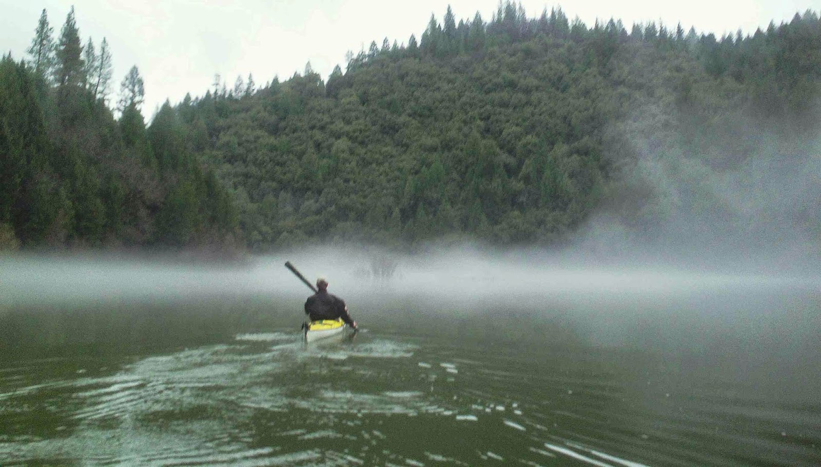
 I'm here with four others from Bayside Adventure Sports. A church sports group based out of the Sacramento area. While most people visit the island via ferryboat, we all paddled in  and are camping at the kayak camp on the northwest side of the island. I had paddled around the island earlier today and now the goal is to hike to its top. A 788 foot climb up Mount Livermore.
The entire island is within Angel Island State Park boundaries and administered by California State Parks. The island has a history of being used in a variety of purposes including, military forts,  missile site,  an US Public Health Service Quarantine Station, and an US west coast Bureau of Immigration inspection and detention facility. Historic building, battery strongholds and installation facilities have been left behind to view on guided tours.
We are steadily climbing up North Ridge Trail on the east end of the island.  We have ascended between 500 to 600 feet since leaving the visitor center. Through the trees we catch views of old Fort McDowell and the bay.  It's a sailor's paradise today. Vessels can be seen skimming across the water in every direction. Their white and shiny sails bounding over their tops on the blue water. Like stars in the heavens there are way to many count.

It's a 5 mile trek around the island. For a dollar extra people can bring their bikes on the ferry or rent one in Ayala Cove while visiting the island. There are 13 miles of hiking trails and roadways on Angel Island. Cyclists have access to 9 of them. However, for the two and half mile trip up to Mount Livermore its all hiking. Steep switch-backs make the trail challenging to even the best of hikers.
At 700 ft. the trail splits into three. While two trails lead back down and one goes to the summit. The trees yield way to the bay for its view. There is still evidence of the 2008 fire that scorched 250 acres there. At 88 more feet we were rewarded with an island's awe-inspiring expansive 360° views of the San Francisco skyline, Alcatraz, the Golden Gate Bridge and Marin County.


It is a view Ayala never got to enjoy for himself.  Ayala had accidentally shot himself in the foot and left most of the exploring to his sailing master Jose de Canizares. On September 17, 1775 he sailed the San Carlos back out through the Golden Gate never to return again. A year later explorer Juan Bautista de Anza led the first colonists to the hilly peninsula facing the Golden Gate and and chose site for the  future city of San Francisco.

 Our visit was short also. When we loaded our kayaks up with our camping gear and paddled away the next morning, unlike Ayala we all look forward to our next visit to the little island.

Friday, May 15, 2015

Kayaking Fargo, Red River Reminiscence


 Originally published on May 6 2014. This post has been an Outside Adventure to the Max fan favorite. 

The city of Fargo has been all the news this past year. It has a new hit TV series that shares its name. ESPN College GameDay came to town for a visit last fall,  and it received rave reviews from the national media about its urban trendy downtown nightclubs, restaurants, and bars. It seems Fargo is cool. After living and raising a family there for quite a while it nice to see it get some positive attention. But, for me, the best part is its river.

 Slicing through the communities of Fargo and it's next door neighbor, Moorhead, Minn,  is the Red  River of the North. This slow-motion friend doesn't seem to be in a hurry at all.  It meanders 550 miles from its source in Breckenridge, Minn all the way to Lake Winnipeg in Canada. In one of the world's flattest places,  the river can pick and chose its own way.  There are not many straight lines in this waterway. In some places along the river, Minnesota is on the west bank, while North Dakota is to the east. Moving very slowly and sloping at just a half-foot per mile, any beginner can navigate this river easily.

Urban paddle through downtown Fargo and Moorhead
Sunset on the Red River.

 Kayaking or canoeing has never been so easy. Along with the cities' parks departments, the Riverkeepers, a nonprofit organization established to protect and preserve the integrity and natural environment of the river in the Fargo-Moorhead area, have developed several access points along the river. Two favorites are located above and below the Midtown Dam in Dike East Park. The dam has been retrofitted with a rocky slope. Fishermen hang out here daily during the summer months.
 From here one can paddle either north through the center of the cites to get views of the skylines and bridges, or go south towards Lindenwood park to escape the bustle.
  It is hard to believe this is an urban paddle as one winds and weaves around with the stream. Willow, cottonwood and box elder trees cradle the river at each bend. In either direction don't be surprised to see beaver, river otters and white-tailed deer. It feels like a trip into the wilderness.
 Of course in other places, one can tell they are in a city.  The sounds of traffic and train horn echo off the water. The music of a jazz guitar floats down from a riverside venue or the Oak Grove High School Band plays its fight song at its football field near to the river. It is always good to remember pizza or a glass of wine are minutes away after the kayaks are loaded up.

Kayaking only stops when the Red River is frozen.
 One of the more popular events on the river is the annual Race the Red kayak and canoe race sponsored by the Riverkeepers.  Each year area paddlers come to challenge skills, raise money for Riverkeepers and have fun. The race features a 10-mile competitive race and a 2-mile fun paddle. The race begins at the Lindenwood Park bike bridge and ends downstream at the floating bridge above the Midtown Dam.  For more information log on to Riverkeepers.org

Lining up for the race.

Debbie and Nick after placing in last year's race.
 I'm now part of the Red River's history. I'm sure no one in recent times had paddled up and down it so much. It's muddy looking waters, ever-changing direction and rumble of its dams still call and always will. I have seen picturesque sunrises and sunsets,  cool morning mists and tranquil snow falls at each bend. I have enjoyed time with family and friends floating on the river as well as solo trips of solitude. The river was a wonderful friend in my journey of life.

Paddling the Red River.

Saturday, May 9, 2015

Up River Without A Shuttle

 “Going up that river was like traveling back to the beginning of the world, when the plants ran wild and the trees were kings. We sailed up an empty river into a great and silent forest"  --Joesph Conrad,  Heart of Darkness...

 In the past couple of weeks, I have been taking trips up the river and then back down. It is challenging in a way for me. All explorers went up the river from Lewis & Clark to Teddy Roosevelt. It's the drive to see what is around the next bend and the anticipation of not knowing what will be seen.

My kayak partner Erik Allen and I were for that challenge last month when we paddled up the North Fork of the American River from Upper Lake Clementine. We had traveled up another section of the river before at a place called Rattlesnake Bar and above Folsom Lake. There is a mixture of lake and river. Above Lake Clementine, it would be all river. Going up the North Fork follows an ever-rising gradient. The water comes in swift fashion. We would paddle pool to pool portaging through the rapids. Erik's longer sea kayak would help him muscle through the fast current a few times by vigorously paddling as hard as he could to pass over the ledge where the water was in a boil. Its nature's rowing machine.

"This is a marathon, not a sprint," Luke Kimmes told the Des Moines Register  "Physically, it's very demanding to paddle nine to 12 hours a day, but a lot of it is up here (he points to his head). It's that mind over matter idea."
Kimmes and five others are on different odyssey this year. They are on the Adventure to Rediscover North America Expedition, canoeing from the Gulf of Mexico to the Arctic Ocean. The journey will take them through ten states, and five Canadian provinces traveling the most way the upstream on the Mississippi and Minnesota Rivers. It's well past 2,000 miles upstream before they are finally going downstream in the Red River Valley of the North and into Canada.
"This is the type of trip I dreamt about when I was a kid," said Kimmes, "It's a passion of mine to show others that getting outside and enjoying the environment is good for the soul. It's a lot better than sitting at a desk."


 I compare it to climbing steps. On some rivers, you will feel a gentle tug or push. When a river turns, it forms a bend. The strongest and deepest current will usually be found on the outside of that curve. So while Erik tries to power paddle through, I take the easy way, finding where the rapids are the narrowest to the pools. Locking my boat against the eddies, a relative calm where the main current flows reverse,  I climb out of my kayak and push it through the fast water. Leaning into the streaming and bracing against the boat.
I have waded before. In the Midwest, we could never really wade in many rivers. Their bottoms were made of mud and silt. You would quickly sink up to your ankles or knees in muck. Don't even think of wearing a pair of shoes. You would either leave them stuck in the mud or spend the next hours trying to scrape the sludge off them. There it's better to go barefoot with the mud oozing between your toes.
 Water shoes are a must today. A couple of weeks ago this water was snow. It is still cold against my legs and feet. This water has enough power to knock me down and the rocks underneath are slippery and jagged. My neoprene boots hold in my warmth and also protect my feet in the rocky river bottom. In my mind, I think about to the explorers and gold miners who stood ankle deep in this cold stream searching for new lands and new treasure. Before long we are back flat water with a roar of the rapids behind us.

"Really, it speaks to what this trip means to me, which is if you have a passion, part of passion is struggling and sacrificing for what you want." said the mastermind Adventure to Rediscover North America Expedition, Winchell Delano in the same interview with Des Moines Register, "The feeling when you cross that divide and you're going downstream again, it's like delayed gratification through cathartic pain."

In the Midwest the slope is measured in inches. It's like pouring water on a pool table and watching it meander to the table's lean. In the foothills of California, if there is water, it comes cascading down the canyons offering scenic beauty and solitude.  At one spot we are treated with the sight of a bald eagle. It pays us no mind as we paddle on in a quiet pool. When soaring, it could be on to the next canyon in the time it takes us to paddle around one bend. It's all new to us, even though it has been mapped, surveyed and Google earthed. When we are out here paddling up stream little matters. It's like we are the first to see it, hear it and touch it.
"Just one more bend," we say to each other. Or maybe even one further up. Lets see how far we can go, powered by trail mix and granola bar before turning back. Then we can turn around and ride the bouncy gentle rapids back to still waters.


Monday, April 27, 2015

Over the Bow: Lake Natoma & the Rainbow Bridge

My talented wife Debbie Klenzman Carlson owner of Progressive Portraits made some impressive images me kayaking Lake Natoma under the Rainbow Bridge in Folsom.


Share your travel stories and images with us at Outside Adventure to the Max.  We are always looking for guest bloggers and their pictures. Check us out on Facebook.

Friday, April 24, 2015

Bay to Bay

                                       
Lake Natoma

 Rivers are the primal highways of life. From the crack of time, they had borne men's dreams, and in their lovely rush to elsewhere, fed our wanderlust, mimicked our arteries, and charmed our imaginations in a way the static pond or vast and savage ocean never could. ---Tom Robbins 


Sometimes I'm just at a loss for words to describe the joy I have for kayaking along on a lake, a river and now the ocean. I got into boating roughly five years ago this month and haven't looked back. Each day on the water fades into a dream only a picture can tell. Bright days, cloudy days and moonlit nights have been chronicled in my photographs of my paddling adventures. Here are a few of my favorite images from this year so far.


Lake Natoma

Paddle Pushers on Lake Natoma


Moonlight Paddle on Lake Natoma

Lower American River
Rollins Lake


Folsom Lake

Folsom lake

Folsom Lake

North of the American River

San Francisco Bay

We are always looking for guest bloggers to share their adventures stories and pictures. Keep up with Outside Adventure to the Max on our Facebook page.

Thursday, April 16, 2015

Our Faithful Strap


 The strap. It is a simple thing. A strong canvas, leather, or woven fabric nylon webbing that offer strong results. Used in place of a rope, its fasteners or buckles hold things in place. A mere two-inch-wide strip nylon can tow a car or truck. They come in a variety of lengths and colors. And when it comes to boating, its overlooked and often forgotten both in our thoughts and literally at the boat access.

You will never see your favorite boater's magazines with headlines like these... New Straps for 2015... Boater's Guide for Straps 2016.... or What Your Strap Color Say About You.  That would just be silly. Canoes and kayaks will always get the glory. Those sleek, majestic and noble crafts that put us on to the lake and stream filling our paddling dreams. But, we ought to realize we would never even get close to the water without our faithful strap.

It was invented before time. Our prehistoric ancestors lashed their supplies together while trekking through the snow across what is now Europe chasing the woolly mammoth.
Needing provisions all tied together all tied together would, of course, help then to inspire travois, dogsleds and then the wheel. If man would travel he would need a strap.

The buckle came later. The Romans would develop it for their soldier's helmets and body armor.  Made out of bronze, these buckles were functional for their strength and durability for the centurion. The concept is still used today in our plastic helmets and buoyant PFDs. But it was the strap that helped conquer the world. To carry a sword, the soldier wore a belt and buckle diagonally over his right shoulder down to his waist at the left holding a scabbard. Therefore, the strap and its buckle became important an element to the campaigning Roman army.

Throughout the ages, the strap and the faster became tools of war, peace and taming the wilderness. When the voyagers were portaging from stream to stream carrying packs laden with pelts while pulling their canoes along through the shallow water, the strap was there of course. Rough work and back-breaking work to say the least. Furs were in 90-pound bundles. If they couldn't be transported by canoe they were carried the men through the shallow waters. The standard load for a voyageur on a portage was two strapped bundles or about 180 pounds. There are reports of some voyagers carrying more five or more bundles and legends of them carrying up to eight. A physically grueling lifestyle not nearly as glorious as folk tales make it out to be and there helping shoulder the load was the fearless the strap.

 Sometime in the age of automobiles, someone thought instead of carrying our canoes over our heads lets carry them over the tops of our Ford. It was revolutionary! No need to rent a boat at the lake when we could take our own trip down river. Tie the canoe down in the truck bed and drop it off at the access. Boundary Waters, Grand Canyon, or the Allagash River. No trip was too big or small for our friend the strap. Since we began carrying our boats with our vehicles, much the gear has had some wholesale changes. Roof racks now come with saddles, rollers and load assist. Trailers equip outfitters to haul numerous stacked boats everywhere. However new technology of boat transport, the strap has stayed the same. You can't change perfection. Its job has been, what it has always been. Hold it and secure it tightly.

We will either carefully tie down our kayaks or yank down on the strap, binding them with all our might. We all do this while taking the strap for granted. We lend them, we toss them and never seem to have enough of them. At the access, we will gently lay our canoes into the water while wadding up our straps into balls spaghetti throwing them into the back of the truck. We pay little concern as they become faded and frayed under the strain of our use. When loading up, one is always invariable left behind to another boater who doesn't have enough of them. Saying to us, "Use me till you lose me. I'll make the sacrifices to get you near the water. I know my time is short."

As you can see the strap is an ageless wonder, however its only a matter of time before your helpful strap is either lost or worn out and left behind in the access dumpster. So I give this tribute to the strap. The guarding of our paddle sports world, forever embracing our wandering.

Sunday, April 5, 2015

Over The Bow: Pink Moon Paddle Video Blog Extra


Come along for this Outside Adventure to the Max's special journey for this video blog extra.
This weekend I took part in full moon paddle with the Sacramento Paddle Pushers on Lake Natoma near Folsom, California. The meetup group's posting called for a full "Pink" moon rising. In poetic fashion, it says, "This Full Moon heralded the appearance of the pink moss, or wild ground phlox—one of the first spring flowers."
Calling this full moon "Pink" is a misnomer because this weekend's "Pink" Full Moon isn't really pink. It will still have the yellowish-white complexion that it always does, that is until early Saturday morning's lunar eclipse, but I'll tell you more about that later.
It refers to the herb moss which grows abundantly in early spring. In Native American cultures, this full moon has many names such as Sprouting Grass Moon, Egg Moon, and among coastal tribes, it's the Fish Moon, because this was the time of year that the shad swam upstream to spawn.
Our ancient ancestors have always looked to the sky. They gave names to the Full Moons to keep track of the seasons. January's full moon is called the Wolf Moon. Because of the warming temperatures when earthworms begin to appear March's moon is the Worm Moon. While September's full moon is called the Corn Moon or Harvest Moon because its when corn was supposed to be harvested. These colorful names all in invoke a certain magic. The moon is our the closest heavenly body in our nighttime skies. For thousands of years, we have used its light to guide us in the dark. What better way to sense its lunar allure than to watch the sunset into golden waters in the west and see the moon climb into the evening sky while kayaking.

Friday, March 20, 2015

Between the Water's Edge...An Interview with Darin McQuoid

 Darin McQuoid grew up exploring and hiking river canyons. Little did he know he would turn it into a career. It was only a matter of time that he would learn to photograph and kayak those same whitewater-filled valleys and share that perspective with the world.
 McQuoid, a California based photographer and white water paddler, has kayaked most of the world on international expeditions to Africa, Pakistan, India, Chile, Argentina, Slovenia, France, Japan, along with trips into Mexico and Canada as well as the USA. With an eye for action, his photographs have been published in National Geographic, Outside, Canoe and Kayak, Kayak Session, Paddler, Rapid Magazine, Kanu and many other publications. Last week we talked to McQuiod about his kayaking, photography and passion for adventure.

NC: How many days did you spend kayaking last year?
DM: The drought made last year tough, but I managed to get out about a hundred days, thanks in a large part to British Columbia.

NC: You are an accomplished kayaker and photographer that enables you to mix both worlds of exciting images and daring exploits. Which came first, the love of photography or whitewater kayaking?
DM: When I started kayaking I was amazed at how little information I could find on rivers I was curious about, so a camera was purchased just to share some of the great places we get to see. 

NC: I try to get a good picture every time I go out on the water.  How about you? Do you need a picture or do you try something new every time you go out? 
DM: I always bring my camera on the river, and most days take at least a couple photographs I've been thinking about. The camera gets left behind two or three days a year. That's added up to 160,000 kayaking shots since I started. 

NC: In your portfolio, it looks like you hike into some pretty remote places to get images of your fellow kayakers. How does it all work? Do you plan out the image and have them make several runs or is all timing & luck?
DM: High end kayaking is dangerous business. I've never asked anyone to run a rapid or waterfall twice, yet I wouldn't consider getting the shot luck either. Whitewater photography lends itself to previsualization. In class V there is generally one line, and as an experienced kayaker I'm able to see that line and know where the fundamental moment of expectation and action will happen. Then I wait for the paddler to get there and it's all about timing. Long term previsualization is knowing what time of day to shoot certain angles for good light.

NC: You have gone down some major whitewater rivers throughout the world as both a photographer and a paddler. Are they all different experiences?
DM: For sure they are. I feel a lot more stress on a paid trip where I need to produce results. It's still fun but a very different experience than paddling with friends for pure fun. It also tends to up the class of a river. On top of dealing with logistics for navigating the river there is a lot of energy spend hiking around to get a good angle for photographs, and mentally you always have to be on and thinking, anticipating the next shot.

NC: What is the strangest thing you have seen on the river?
DM: I have not seen anything too crazy, just some great wildlife moments like bears swimming across and a reindeer swimming in Newfoundland. The strangest things seem to happen while running shuttle, there are some interesting people out there.

 NC: You have been around. However, is there a river or area you want to photograph & paddle that you just haven't been to yet? 
 DM: Oh too many to list, Myanmar would be number one, Réunion Island would be incredible, Kamchatka peninsula and there is still a lot more stuff in Patagonia that would be great to explore. 

NC: You said, "Being a great kayaker is not just about kayaking skill. It's also about being an ambassador for the sport on and off the water, as well as being a true team player on the water." Like you, I find everyone is pretty much your friend when they have a paddle in their hand. Why in  such a competitive world is there such alliance in the world of kayaking? 
 DM: It's such a small fringe sport it lends itself to a tight knit community. Plus unlike skiing, just because someone else went first doesn't mean the line is tracked out.

Web Site and/or Blog Site Link: www.darinmcquoid.com

Friday, March 13, 2015

Over The Bow: The Otter Tail River

 
The first river you paddle runs through the rest of your life. It bubbles up in pools and eddies to remind you who you are.  -- Lynn Noel

It was an uncommonly warm day in March of 2012. That year's winter was unfamiliar, to begin with. It had been a snowless Christmas for the area for the first time in 50 years and only a few snowstorms followed into February.  The Red River Valley's rivers weren't on the rampage for the first time in years and their winter top coat of ice was being shed easily. Temperatures were racing into the 70s,  making it hard to resist my first trip kayaking that year. I ordinarily started in late April while living in Fargo, N.D.  Paddling in the upper Midwest is a seasonable transition. Break the kayaks out in the late spring. Paddle as much as you can all summer long. Dodge the leaves, rain then snowflakes during autumn and grumble about the cold while stowing the boat away for the long winter.
The Otter Tail River was clear, low and running slow. I always kicked off my paddling seasons on that river. It is a delightful waterway weaving through woods, marshes and farmlands in the heart of Minnesota's lakes country. I would be paddling upstream from the highway access off 210 just east of Fergus Falls. Its popular put in and take out spot along the river during the summer for canoeists and tubers alike. However, that day I had the river to myself.
 I would loop in and out of the channel going up river. In the shadows, snow was still clinging to the banks of the river. Around a bend, I came across the large sheet of ice spanning most of the river. It had the look of a glacier. The March sun, however, was taking control.  The ice was being rapidly melting away with each drip falling back into the river. Spring was on its way and the paddling season had begun.

Over the Bow is a new feature from Outside Adventure to the Max, telling the story behind the image. If you have a great picture with a great story, submit it to us at nickayak@gmail.com

Friday, March 6, 2015

Rattlesnake Bar's Visionary Enchantment

“As we passed on, it seemed as if those scenes of visionary enchantment would never have an end.” --Meriwether Lewis

I have always found that visionary enchantment Lewis writes about on my trips at Folsom Lake State Recreation Area's Rattlesnake Bar and up the North Fork of the American River. Gliding in clear water along a passageway between massive granite ramparts cradling the lake and river. The canyon walls also flow in patterns of the stream. The once molten rock now crystallized over millions of years has been lifted and exposed. Thin-bedded sedimentary layers have been shattered and busted along the fault lines while large boulders have become their own islands raising from the depths.

When I started kayaking I dreamed of being in a place like this. These were the places pictured in the favorite kayak magazines. Quiet inviting pools of water with amazing scenery, while just around the bend the ripples have turned into churning cascades. The sound of the thundering water echoing off the chasm walls has always called to me.

It is a warm day in March and the lake running high. It’s a far cry from more than a year ago when I was driving and walking on the lake’s floor. Now the lake is nearly double with the water it at about 100 percent of normal, meaning the lake levels are where they should be, despite the ongoing drought. It's a good sign. I'm able to paddle farther into the North Fork's canyon than I have before, passing the long gone miner's gold camps. During the Gold Rush thousands of miners picked, dug and blasted along the banks of the river looking for fortune, but today it is only me finding the riches of the lake and stream.

Before long the placid lake turns into moving water. I feel the tug of current pushing me back. At a couple rapids, I leap-frog the fast water by portaging my kayak. I hopscotch between the uneven rock. The footing isn't great. I find sandy beaches below each rapid along with clear blue pools. In summer this would be an inviting spot for a swim. However, it is March and the water remains liquid snow from the Sierra. Swimming will have to wait till next time. I press on until being stopped by a long line of rapids.

I have lunch on the beach and then go with the flow. I catch the current enjoying a bouncy ride to quieter waters.


Thursday, January 29, 2015

Water Access Could Be Restricted In Washington State

 
It was raining hard on the South Fork of the American River. We unloaded our kayaks from our parked car just off the Highway 49 and walked a crooked path to the river. Under the bridge we escaped the rain and found easy access to the river. We were soon paddling down the river.
It is a scene I have done time and time again. Using the bridge right-of-away to gain access to the waterway. Across the country, informal access sites are used by paddlers and fisherman along roads and within bridge right-of-ways to get to the lake and stream in a few simple steps.
That all might change in Washington State with a bill underway this legislative session that would severely limit access to the state's waterways. The bill introduced by Representative Larry Haler from Richland,  would prohibit water access on small parcels of public land unless the managing agency provides a formal river access site and parking lot. Under proposed legislation, public land managers would be required to post signage that public access to the water is prohibited on small parcels of public land without formal parking that currently provide access to our state's waterways. Violators would be charged with a misdemeanor.
 I support development of river access and designated parking sites along the waterway's corridor where use levels are a practical investment. I have used many public access sites over the years enjoying their benefits. However, I still feel this would hamper and limit many paddling experiences along rivers without access points and fear it might be used as precedent for other states restricting water access.
"Diligence and recurring defenses of our freedoms that we often take for granted is a never ending responsibility of the many, not just the few." posted Californian kayaker Dan Crandall on Facebook, "Those fights can manifest themselves in places you might never expect, and therefore you must be prepared to recognize the signs when they appear. I'd call this a sign to be noticed before the battleground grows. Let your Washington state friends know."
 
The full text of the bill is below:
 
 House Bill 1056:
 
AN ACT Relating to restricting the use of certain parcels of public land to access a public body of water; adding a new section to chapter 79.02 RCW; and prescribing penalties.
 
BE IT ENACTED BY THE LEGISLATURE OF THE STATE OF WASHINGTON:
 
NEW SECTION. Sec. 1. A new section is added to chapter 79.025RCW to read as follows:
 
(1) If a parcel of public land is one-quarter of a square mile or less in size and is adjacent to a body of public water and the land is or can be used to access the body of public water, the governmental entity which has jurisdiction of the land must provide adequate public parking for persons utilizing the land to access the water.
 
(2) If adequate public parking is not provided, using the land to access the water for other than a governmental purpose is prohibited. If adequate public parking is not provided, the governmental entity which has jurisdiction of the land must post a warning sign for the public that clearly shows that using the land to access the water is prohibited and states the sanction for a violation of the prohibition.
 
(3) A violation of this section is a misdemeanor.


Saturday, January 17, 2015

Urban Paddler

The Mississippi River and downtown St Paul, Minnesota.
There is a whirl of activity at Hidden Falls Park in St. Paul, Minnesota. Shuttle buses are coming and going. Kayaks and canoes are being unloaded and carried to the grassy staging area next to the river. Numbers are have been assigned, pictures are being taken, while water, apples and granola bars are packed into the boats. It is the annual Migthyssippi River Adventure Race day on the Mississippi River. Over a 100 hundred paddlers have signed up for the 14-mile charity event through the Twin Cities. The paddler's instructions on the river are easy: Be Safe, stay to the right of the river when traveling downstream. Avoid all boats and barges and have fun.
A countdown from the loudspeakers and soon the river is filled with kayaks and canoes of every color and size. Before long the paddlers spread out going past Fort Snelling State Park and the skyline of St Paul giving each one their own perspective of the famous river. At times it is gritty and industrial, but also offers an oasis of nature in the heart of city dwellings.
Most paddlers feel like they are discovering it for the first time. They are surprised that an urban river can contain so much beauty and nature. It happens all the time for urban paddlers. The waterways thought to be dirty and polluted are found clean, inviting and full of wildlife. On the Red River between Fargo and Moorhead, I have seen deer, beaver and even a bald eagle along the bends of the rivers just blocks away from downtown. River otters splash and hide in the rocks underneath the Rainbow Bridge over Lake Natoma and the American River, while farther down Californian quail, deer, and Canadian geese find a haven in the sloughs.

The American River Parkway

On the river urban views are blocked by trees. The only reminder that one is even close to civilization is going to the cities train and highway bridges. The buzz of traffic echoes off the water giving us the only clue we are close to home. In some places, we go back in time past turn of the century mills and remnants. Along the Red River on the Moorhead side, I can still find broken bottles from the prohibition days when North Dakota was dry and Minnesota taverns were right on the river. On the American River, huge piles of dredge tailings are still visible from gold mining days. The waterways are no longer highways or dumping grounds and the rivers have now reclaimed their banks.

Paddling in downtown Fargo, North Dakota.

Canoeist Natalie Warren founder of the outdoor education nonprofit Wild River Academy has trekked the waterways across the country to observe how rivers are promoted in their communities. In a recent interview with Canoe & Kayak Magazine said, "When I paddled urban rivers from Minneapolis to Hudson Bay and from Minnesota down to the Gulf of Mexico, I realized that our local water trails have their own beauty and, even more, provide a classroom to learn how our country uses rivers. My experiences on wild and urban rivers inspired me to speak about building a culture around urban paddling, diversifying the paddling community, and increasing recreation, positively impacting all aspects of society."

Natalie Warren left and Ann Raiho in Fargo, N.D., during the 2011 Minneapolis to Hudson Bay Trip

Warren's goal is to increase recreation through the public waterways in river towns with the addition outfitters, hiking and bike paths, restaurants and interpretive centers, campgrounds and most important access to the water.
 "I hope to highlight the positive ripple effects of opening up to the river and prioritizing water trails to improve recreation and trails, tourism and economies, and increased environmental education and ecosystem health. It all starts with a paddle in the water. Every time you paddle locally you are partaking in a larger movement for the betterment of communities, ecosystems, and the future of river-town economies."
Paddlers taking part in the Mightyssippi River Adventure finished the day under the Interstate 94 bridge, 14 miles downstream. They came away with sore muscles and smiles with this annual day on the Mississippi. Of course for some, this experience is only a warm up to their annual Boundary Waters trip or lifelong dream of going down the Grand Canyon. However, paddling locally and exploring their neighborhood water trail gave them a low-cost view of the river, right in their own backyard.


Thursday, October 9, 2014

Whitewater, October 1805

Photo from the National Geographic Production 2002 of Lewis & Clark: Great Journey West.

In the fall of 1805 the Corps of Discovery put their newly fashion dugout canoes into the fast-moving Clearwater river and for the first time in nearly two years had the current to their back. Captains Meriwether Lewis and William Clark had faced many nautical challenges since leaving St. Louis, Missouri, in May 1804, but nothing in their experience had prepared them for the falls and rapids that lay ahead on what is now Idaho and eastern Washington.

 "October 7, 1805, All the canoes in the water. We load and set out, after fixing all our poles &c...Proceed on, passing many bad rapids. One canoe, that in which I went in front, sprung a leak in passing the third rapid." ---William Clark  

 Whitewater rapids are rated according to difficulty from Class I (easy flow and small waves) to Class VI (virtually unrunnable). Even with today’s high-tech kayaks and rafts, Class V rapids are not included on most commercial river trips. Navigating the rocks, waves, dangerous currents, and steep drops of Class V rapids require scouting and expert paddling skills. The men of the Corps of Discovery would have to develop these skills along the way if they expected to survive.

"October 14, 1805, In passing through a short rapid opposite the head of an island, ran on a smooth rock and turned broadside. The men got out on the rock, all except one of our Indian chiefs, who swam on shore. The canoe filled and sank. A number of articles floated out." ---William Clark

They were nearing the junction of the Snake and Columbia Rivers. It was late in the season and urgency was on their minds. They needed to make miles no matter what unknown rapids roar ahead, around the bend. They took many chances paddling the rough water losing tomahawks, shot pouches, bedding and clothing, but never a canoe, rifle or man.

"October 16, 1805, Determined to run the rapid. Put our Indian guide in front, our small canoe next, and the other four following each other. The canoes all passed over safe except the rear canoe, which ran fast on a rock at the lower part of the rapids. With the early assistance of the canoes and the Indians, who were extremely alert, everything was taken out, and the canoe got off without any injury...At 14 miles passed a bad rapid, at which place we unloaded and made a portage of 3/4 of a mile, having passed 4 smaller rapids." ---William Clark

About a week later the Corps of Discovery encountered Celilo Falls. The beginning of a 55-mile stretch of the Columbia River proved to be the most difficult and dangerous part of their journey through the Pacific Northwest.

Celilo Falls 1899
October 23 1805, I, with the greater part of the men, crossed in the canoes to the opposite side of the falls and hauled them across the portage of 457 yards, which is on the larboard side and certainly the best side to pass the canoes. I then descended through a narrow channel, about 150 yards wide, forming, a kind of half-circle in its course of a mile.---William Clark

The portage of the falls gave them little trouble. The explosive Short Narrows and The Long Narrows were another matter. The Short Narrows was a 45-yard wide single channel of raging whitewater. The local Indians considered the rapids impassable. Clark and the corps' best boatman, Peter Cruzatte went ahead to scout it out for themselves. They heard the roar of the water and saw what Clark would later write, "Whorls and swells arising from the compression of the water."  They agreed, that the portage of their heavy canoes over the high rocks would be nearly impossible and by good steering and avoiding the rocks they could make it through safely.

 October 24 1805, I determined to pass through this place notwithstanding the horrid appearance of this agitated gut, swelling, boiling, and whorling in every direction which, from the top of the rock, did not appear as bad as when I was in it. However, we passed safe, to the astonishment of all the Indians, who view us from the top of the rock.---William Clark


The Short Narrows of the Columbia 1950

The next morning the men repeated the scene again at the Long Narrows. The non-swimmers and the valuable baggage portaged around the rapids while the rest of the party shot through them in the dugout canoes.
  
"October 25, 1805, The three first canoes passed through very well; the fourth nearly filled with water; the last passed through by taking in a little water. Thus, safely below what I conceived to be the worst part of this channel, felt myself extremely gratified and pleased. 
We loaded the canoes and set out, and had not proceeded more than 2 miles before the unfortunate canoe which filled crossing the bad place above, ran against a rock and was in great danger of being lost. This channel is through a hard rough black rock, from 50 to 100 yards wide, swelling and boiling in a most tremendous manner." ---William Clark

The Long Narrows 1951

With no question, today's whitewater kayakers and rafters would enjoy a special thrill of retracing the Corps of Discovery's trek through these incredible sections of whitewater if they only could. But, most of the challenging rapids are just memories now after being submerged behind a series of hydroelectric dams in the 1950s.

William Clark's comments came from The Journals of Lewis And Clark, edited by John Bakeless,  copyright 1964.

Wednesday, September 3, 2014

Going Against the Flow.


Only dead fish go with the stream...

When I look back on my kayaking trips I rarely have had a shuttle waiting for me at the river's end, not that I wouldn't mind one. But, when you solo as much as I do, you learn to do without. It's convenient to park, unload and paddle-up stream as far as I can or that time permits.

Now I'm not paddling up the Colorado. I find gentle flowing rivers with a little gradient. I have learned to read their eddies and flows. When the river turns, it forms a bend. The strongest, deepest and fastest current will be found on the outside.  Toward the inside, the water moves at its slowest.
Staying to the river's inside is where the current provides the least resistance. I hug those soft lines on their insides. Back and forth, side to side, I paddle wherever I find the least current. Where the river flows the quickest, I feel a nudge. That is where the river is telling me, I'm going this way.

 Rivers are like that.  It doesn't care about your future. It has already been upstream and is now looking for an effortless path to the sea. If you want to tire yourself out going against the river's torrent, it might say, "That is your problem. I'm looking to be lazy. Paddle up far enough and I'll convince you to turn around. Why fight it? Just go with the flow."

Old guys fish and teenagers swing from ropes tied to trees limbs along the bank as I paddle near. It is leisure time for them. They study me as I endeavor against the so-called current,  like I was coming from another place in time. 
"Wouldn't it be easier going the other way?" one calls out.
 "It would be faster," I respond.

I can hear the slight roar of the rapids while paddling up. It is a negligible whooshing. It's around the bend. I know it is coming. On the Upper American River I find a few spots where I have to wade through the stream while pulling my kayak up past the rocks. It was here, I think, the early explorers pulled their crafts up river looking for the source. The rocks are slippery and rugged as I wade through ankle deep water. It brings out the frontiersman in me. I remember watching the old western where the heroes forded the streams. It is a short portage for me. Its only yards till I get to calmer and deeper waters.

Before long I get to a dam, another series of rapids or my body will have had enough. I then turn the bow into the current and feel the power of the water turn me around. This is my reward, but I'm too tired and out of breath to enjoy my triumph.


Friday, May 30, 2014

Adventures at Rattlesnake Bar & Folsom Lake


The river called. The call is the thundering rumble of distant rapids, the intimate roar of white water . . . a primeval summons to primordial values. — (John Craighead, Naturalist Magazine (Autumn 1965)
  Where the North Fork of the American River flows into Folsom Lake is one of my favorite spots to paddle. At the far northern end of Folsom Lake State Recreational Area, Rattlesnake Bar is a little out of the way.  It is off the highway and down a winding road to the lake access. Because of the current drought, getting on the water is inconvenient.  Last time I was there, the boat ramp gate was locked, leading to a long portage to the water.
 Nevertheless, once on the water those troubles drifted away. The water was calm, flat and suited for touring. It's spellbinding to explore the towering rock formations and coves of the lakeshore.  At  Mormon Ravine, if conditions are right, the water is boiling. Discharges from the nearby pump house have turned the mild stream into a rocky watercourse just right for surfing.
  The guys from Bayside Adventure Sports and I were lucky one evening to catch a flow release into the ravine. We tested our skills enjoying that thrill of whitewater before heading back home on the peaceful lake.

Tuesday, March 25, 2014

Where the River Ends...Rattlesnake Bar.

Where the river ends...The North Fork of the American River flowing into Folsom Lake
 All my paddling books were written about 15 years ago. Each offers maps and tips on where to go and how to get there.  They have suggestions on the obstacles one might encounter and what sights to look for a long the way. It is very helpful knowledge for both the beginner and the veteran paddler.
 However, Folsom Lake is now at an all-time low. Where my GPS says there should be water,  looks more like the surface of Mars. The waterway which has definitely shrunk offers now new opportunities to explore areas that were once underwater. Look for massive and remarkable rock formations resembling fortresses and castles along the shoreline and giant boulders rising up out the water from nowhere.
 Rattlesnake Bar is the furthest north boat access point on the north arm of the lake at Folsom Lake State Recreation Area. The landscape there is very rugged. The guidebooks say watch for rattlesnakes, hence the name, but look out for other wildlife as well.
 At the time, the lake level had dropped far below the cement of the boat ramp. Along with that, the gate leading to the ramp was locked. Portaging the kayak down the hill was in order to get on the water.  Once on it, I found the water very quiet while paddling up past Morman Ravine.  Here is where the water clarity improved as the icy North Forks of the American River water meets the warmer lake water.  At this place,  it was easy for me to see into the depths of the lake below. In places, I could see clearly twenty to thirty feet into the bluish green water.
 A giant gravel bar soon appears. It is the reminder of the power water. A flood destroyed a cofferdam some years ago sending a wall of water and dam material all downstream. The water at this point became shallow and the current started to tug at my kayak.  I had to stop and turn around just before hitting some Class I rapids. This is where the river ends.
 I will have to wait until the lake is higher to conclude this journey.


Tuesday, March 18, 2014

Kayak Journals, My History of Paddling

Lake Journals
May 27, 2010...Cole and I put our kayaks into the water.  The day had finally came. It is a beautiful day in Minnesota.

That's it. That is how it all started.  My son Cole and I put our brand new Perception and Old Town kayaks into Red River Lake just east of Elizabeth, Minn.  The day was bright and warm. The water was clear and smooth. We had just found out how to adjust our seats and our footpegs. I guess we were a little shaky at the start.  But, soon we were watching the turtles jump off the logs in the quiet spots of the lake

 The only reason I can remember this so well is that I began to write a kayaking journal that very day to keep track of my paddling adventures. I have chronicled every day since I have put a kayak in the water. With three completed journals and one just begun, I currently have documented 300 days of kayaking. The books are small little travel journals with about 200 pages, offering spaces on each page for several paragraphs. The top of every other page of the journal contains a "highlight of the day" section. I usually reserve this space for a map, newspaper headline, but most often a photograph.
May 2010 on the Otter Tail River

 The pictures have documented my complete kayaking experience. Some of my favorite images include Cole and I holding our paddles over our head in triumph, the many over-the-bow shots of sunrises and sunsets in places called Itasca, Bemidji and Clementine, rustic campsites by lakes and rivers where I  hear the cry of the loon and those postcard memories of both whitewater and calm water from Superior to California.

  The pictures also include friends and acquaintances that I have taken out on the water with me.  For many, it is their very first time in a kayak.  Most of them start out with the same question.
 "Is this going to tip over with me in it?"
  And at the end of the day when we are loading up the boats, it is always the same question.
 "When can we go again?"

Photos of my kids, my wife and even my dog blanket the pages. Like the shots of Cole white-watering on the Kettle River,  my son Taylor and daughter Alia sitting around a fire on a campout, or  Noel on leave from the Navy in a much smaller boat than her USS Nimitz, while paddling on the Otter Tail.
The pictures record the courtship with my wife.  There are images of Lake Natoma backwater on our first kayak outing. A great shot of our bright smiles after placing in the Race on Red Canoe & Kayak Race. Plus travel snapshots of a northern Minnesota camp out complete with mosquitoes, a thunderstorm in Colorado and coming back home again at Lake Natoma.

 July 4, 2013...This river has a way of slowing downtime. The sun hangs like a big orange ball sinking just slowly, slowly, slowly. The trees reflect in a mirror image of the water.  It is very still, till the echoes of fireworks shatter the silence. After all, it is the fourth of July.

 There are essays about being lost on watery trails. Bodies of water have a way of revealing beauty and tranquility in the world  It is awesome to kayak in wonderful places. However, my pictures don't even come close to capturing the splendor of seasons surrounding my kayaking.  My words, has hard I try, don't come much closer. I try to embrace the fleeting spirit of the lake or stream of the day in my passages. Rivers leave no footprints. Each time it is a different memory. The old cliche, "It's the journey that matters" still rings true.  I look back through the pages of stored experiences reliving those hot summer nights on Minnesota lakes, the touch of autumn in Maplewood State Park, my freezing fingers of a first snowfall and the high water voyages during spring runoffs.

 Sometimes the entry is a combination weather report and a laundry list of where I went, who came with, did it rain or shine? and what did I have for snacks? Those entries are pretty simple. I usually describe what I saw along the way. If the lake was full of kayaks or if I had it pretty much to myself.  Did I see any wildlife? Was the weather pleasant or breezy? A record that I got for a 90-minute paddle across the water on a mid-week late afternoon.

It is second nature to me now.  I have made it a habit that either at home or by the campfire, I put down a few lines about the day's paddling. I have even expanded to other journals to keep track of my cross-country skiing, biking and hiking outings. I like to look back, to see where I went and how I traveled down the trail that day.

 August 16, 2012...The night is cool, but still very beautiful and even peaceful. I could have paddled even more, except for the setting sun.

 It is not for everyone, I agree, but for those who enjoy remembering their days on the water, I would recommend it. It will make each trip, whether a long day's journey down a river or a quick outing on the lake, an odyssey.

Tuesday, March 11, 2014

On the Parkway with the Paddle Pushers


On the American River Parkway with the Sacramento Paddle Pushers.

 Most of the 23 miles of the American River Parkway meanders through the urban part of Sacramento in slow motion.  The recreation river has few ripples in places, but mostly it's a slow easy ride all the way down to the Sacramento River. Paddlers will have little trouble going against the current from confluence of the rivers up to the I-80 bridge. There are two access points for boat launching.  Tiscornia Park is just to the south of Discovery Park. It offers a small craft access underneath the Jibboom Street bridge that link the parks. Discovery Park offers one for the larger pleasure boats.  From there up stream the slow moving river offers a view several bridges to mark the progress of your trip.

 It is definitely an urban paddle. In some spots downtown skyscrapers can be seen.  Homeless camp on the banks and boats zoom by on way to a fishing spot. However, the river corridor still offers great views of birds and other wildlife. Turtles can be seen sunning themselves on logs along the river, while a number of herons nest in the trees. River otters and beaver can also be spotted along the way. This makes the parkway a great place for a weekend paddle.

 The Sacramento Paddle Pushers an online meet up group, embarked on the river this past weekend.  Over 20 some paddlers were enchanted by the river's natural surroundings and history during their outing. The group's organizer Lynn Halstead, wanted get more people out kayaking together. She began the group in October of 2010.  It now boast about 500 online members. Since, Halstead has hosted numerous paddling, biking and hiking activities. She also plans the outings months ahead in some cases.
"I just wanted to start my own group and it keep getting better." said Halstead, "It is only amazing because of all people I have come out. Just meeting all the wonderful paddlers."

 The Paddle Pushers paddle up stream from the Jibboom Street launch.  They traveled about 4 miles before stopping for a lunch break. After lunch the group returned in a relaxed fashion going down stream.


The trip on the American River Parkway.